艺术
美容与健康
工艺
文化与历史
娱乐
环境
食品与饮料
逆向工程
科学
体育
技术
可穿戴设备
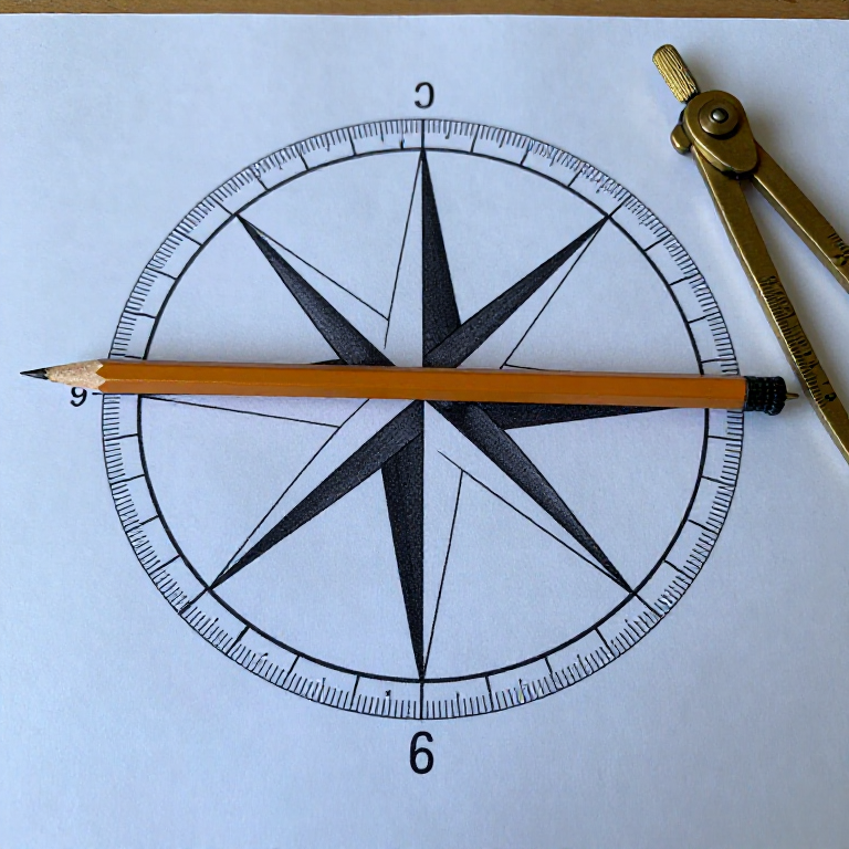


Chartwork: True, Magnetic and Compass
There are three different norths, and a navigator has to move between them constantly. The chart is drawn on TRUE north. The compass needle points at MAGNETIC north, which is somewhere else and moves year by year. And the compass in the boat points somewhere else again, because the boat's own iron and electronics pull it.
Those two offsets are called VARIATION and DEVIATION. They are not errors to be lamented — they are known quantities to be applied, and applying them in the right direction is the single most practised skill in coastal navigation, because getting the sign wrong puts you twice the offset out rather than nothing.
This rung is the arithmetic that connects the chart to the thing in front of the helm, and the method for measuring your own boat's deviation — which no table can give you, because it is a property of that hull.
中级
1 day
说明
1
1
Read the variation off the chart, for this year
Read the variation off the chart, for this year
The compass rose on the chart states the variation at a stated date, with an annual rate of change. Apply the years elapsed.
Variation is geographic: it differs from place to place and drifts with time as the earth's field moves. On an old chart the stated figure can be several degrees stale, which at ten miles is a mile of error. Write the variation you are using on the chart in pencil, with the year, so the assumption is visible rather than remembered.
2
2
Swing the boat to find your own deviation
Swing the boat to find your own deviation
Line up two fixed marks whose true bearing you know — a transit — and steer the boat slowly through a full circle, reading the steering compass as the transit comes on. Do it on eight or twelve headings.
The difference between what the compass reads and the known bearing is the deviation ON THAT HEADING. It is not a single number: it changes around the compass, typically as a smooth curve with two maxima. Tabulate it, and keep the card where the helm can see it.
所需工具:
 指南针
指南针 双筒望远镜
双筒望远镜3
3
Learn one direction rule and use it always
Learn one direction rule and use it always
Going from the chart to the helm — TRUE to COMPASS — you ADD westerly variation and deviation. Going from the compass to the chart you subtract them. The old mnemonic is 'Error West, Compass Best; Error East, Compass Least'.
Choose one mnemonic and never mix it with another, because the classic disaster is applying a correction the wrong way and ending up twice the error out. Write the working down every time: True, Variation, Magnetic, Deviation, Compass, in that order, in a column.
4
4
Keep iron away from the compass, and prove it
Keep iron away from the compass, and prove it
Note what is near the compass — a phone, a torch, a tool, a loudspeaker, an engine — and test each one by bringing it up while watching the card.
A mobile phone laid beside a compass can swing it twenty degrees, and nothing about the compass will look wrong. Deviation measured with a tidy boat is not the deviation you have with a toolbag on the seat. Mark a keep-clear zone and treat any change in the boat's metal as a reason to swing it again.
所需工具:
指南针5
5
The conversions, and what a sign error costs
The conversions, and what a sign error costs
正在加载 Jupyter 笔记本…
6
6
Write the working on the chart, not in your head
Write the working on the chart, not in your head
Set out every conversion as a labelled column in the log, and pencil the final course on the chart beside the line.
Mental arithmetic in a seaway is where sign errors live. A written column can be checked by someone else, and it can be checked by you in ten minutes when the depth is not what you expected. It costs fifteen seconds and it is the cheapest insurance in the boat.
相关蓝图
这些蓝图共享知识——技术、材料或原理



CC0 公共领域
此蓝图以 CC0 协议发布。你可以自由复制、修改、分发和使用此作品,无需征得许可。
通过购买蓝图中的产品支持创客,他们将获得 创客佣金 (由供应商设定),或创建此蓝图的新版本并将其作为连接包含在你自己的蓝图中以分享收入。