УРЛАГ
ГОО САЙХАН БА ЭРҮҮЛ МЭНД
ГАРААР ХИЙСЭН
СОЁЛ БА ТҮҮХ
ҮЗВЭР НААДАМ
БАЙГАЛЬ ОРЧИН
ХООЛ БА УНДАА
УРВУУ ИНЖЕНЕРЧЛЭЛ
ШИНЖЛЭХ УХААН
СПОРТ
ТЕХНОЛОГИ
ӨМСДӨГ ХЭРЭГСЭЛ
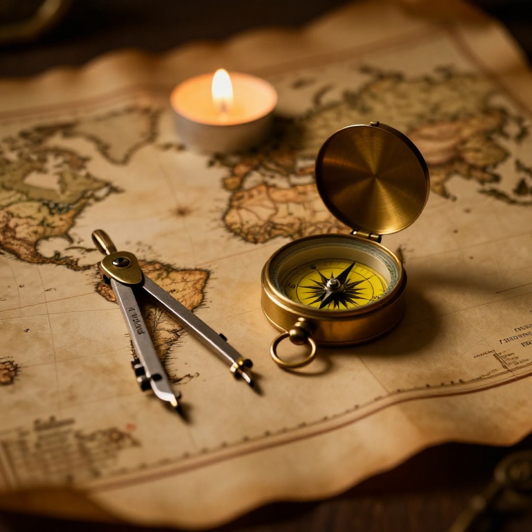


The Mercator Map — Peel an Orange and See Why Flat Maps Lie
A hands-on maths project: draw the continents on an orange, then peel it and try to flatten the peel -- discovering you cannot flatten a sphere without stretching it. That is the mapmaker's dilemma Mercator solved in 1569. A Python cell measures the famous Greenland-versus-Africa distortion, and a compendium reaches to Google Maps.
Анхан шат
30 minutes
Зааварчилгаа
1
1
You cannot flatten a ball
You cannot flatten a ball
The Earth is round but maps are flat, and there is no way to flatten a sphere without stretching or tearing it. Every flat map is a compromise. In 1569 Gerardus Mercator chose a clever one. You will feel the problem with an orange.
2
2
Map an orange
Map an orange
Draw a simple world on an orange with a marker: a squiggle for the equator, blobs for a few continents, dots for the poles. Try to keep the sizes fair.
Энэ алхмын материал:
 Жүрж1 ширхэг
 Зузаан цаас1 ширхэг
Шаардлагатай багаж:
 Бал харандааны иж бүрдэл
3
3
Peel it and flatten it
Peel it and flatten it
Now peel the orange and try to press the peel flat on the card. It will not lie flat without cracking and tearing -- and to make the pieces meet you have to STRETCH them, especially near the poles. That stretching is exactly what a Mercator map does: to keep compass directions straight for sailors, it stretches everything more and more toward the poles.
Шаардлагатай багаж:
 Хайч
Хайч4
4
Measure the distortion
Measure the distortion
Jupyter дэвтэр ачаалж байна…
Шаардлагатай багаж:
 Ширээний компьютер
 Тооны машин
5
5
Compendium: the map that shapes our world-view
Compendium: the map that shapes our world-view
What the orange teaches. (1) No flat map can keep shapes, areas AND directions all true at once -- pick two and you lose the third. (2) Mercator kept compass bearings straight (a constant heading is a straight line on his map), which made ocean navigation simple, at the cost of hugely inflating areas near the poles. (3) So Africa and South America look far smaller than they are, and northern countries far larger -- a real distortion of how we picture the world. (4) A version of it, Web Mercator, is what Google Maps and almost every online map still use today, because straight-line bearings are convenient and the maths is simple.
Шаардлагатай багаж
4- Түр орлуулагч
- Түр орлуулагч
- Түр орлуулагч
- Түр орлуулагч
Холбоотой загварууд
Эдгээр загварууд мэдлэг хуваалцдаг — арга техник, материал эсвэл зарчим
CC0 Нийтийн домэйн
Энэ загвар CC0 дор гаргагдсан. Та зөвшөөрөл авахгүйгээр хуулах, өөрчлөх, түгээх, ашиглах боломжтой.
Загвараар дамжуулан бүтээгдэхүүн худалдаж авч Бүтээгчийг дэмжээрэй Бүтээгчийн шимтгэл Борлуулагчаар тогтоосон, эсвэл энэ загварын шинэ хувилбар үүсгэж орлогоо хуваахын тулд өөрийн загварт холбоос болгон оруулна уу.