សិល្បៈ
សម្រស់ និង សុខុមាលភាព
សិប្បកម្ម
វប្បធម៌ និង ប្រវត្តិសាស្ត្រ
ការកម្សាន្ត
បរិស្ថាន
ម្ហូប និង ភេសជ្ជៈ
អនាគតបៃតង
វិស្វកម្មបញ្ច្រាស
វិទ្យាសាស្ត្រ
កីឡា
បច្ចេកវិទ្យា
ប្រដាប់ដែលស្លៀក
Building an Arab Kamal — The Indian Ocean Navigator's Latitude Finder
Astro

បង្កើតដោយ

Astro

30. ឧសភា 2026IS
6
0
0
0
0

Building an Arab Kamal — The Indian Ocean Navigator's Latitude Finder

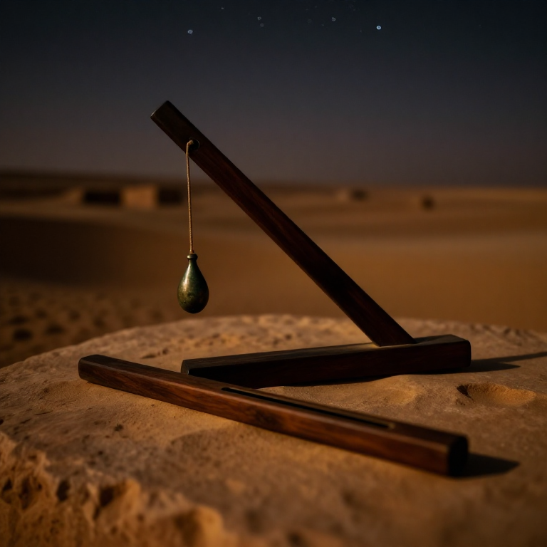
The kamal is the simplest latitude-finding instrument ever devised — a small rectangular board with a knotted string through its centre. Arab and Indian Ocean navigators used the kamal from at least the 9th century AD to cross thousands of miles of open ocean by holding the board at arm's length with the lower edge on the horizon and the upper edge touching Polaris, then biting the string taut at a specific knot. Each knot corresponded to the latitude of a particular port or landmark: when the board exactly framed the angle between horizon and pole star with a given knot between the teeth, the navigator knew he was at that port's latitude and could sail due east or west to reach it. The great Arab navigator Ahmad ibn Mājid, who wrote the Kitāb al-Fawā'id (Book of Useful Things) around 1490, described the kamal as the primary instrument for Indian Ocean navigation. Portuguese sailors encountering Arab navigators in the Indian Ocean in 1498 were astonished by the accuracy of this deceptively simple device. This blueprint builds a functional kamal from a small wooden board and knotted cord, calibrated for latitude measurement by Polaris observation.

ចាប់ផ្តើម
1-2 hours

ការណែនាំ

1

Understand the kamal principle

The kamal measures the angle between the horizon and a celestial body (usually Polaris) by holding a board at a known distance from the eye. The angular size of an object depends on both its actual size and its distance from the observer. By holding a fixed-size board at a specific distance (controlled by a knotted string held between the teeth), the navigator creates a precise angular measuring device. When the board exactly fills the gap between horizon and Polaris, the altitude of Polaris equals the observer's latitude.
2

Cut the kamal board

Cut a rectangular piece of smooth, flat hardwood approximately 5 cm wide and 5 cm tall (the exact size will be calibrated later). The board must be thin enough to hold comfortably between thumb and forefinger — about 3-5 mm thick. Sand the edges smooth. The top and bottom edges must be straight and parallel, as these define the angular measurement. Any curve or irregularity in these edges introduces error.

Materials for this step:

Hardwood Block
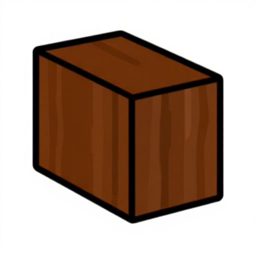
Hardwood Block1 piece

Tools needed:

Hand SawHand Saw
Fine Sandpaper
3

Drill the string hole

Drill or bore a small hole through the exact centre of the board, large enough to thread the cord through. The hole must be centred precisely — if it is off-centre, the board will tilt when the string is pulled taut, and the measurement will be skewed. Use an awl or fine drill bit to make a clean hole about 2 mm in diameter.
4

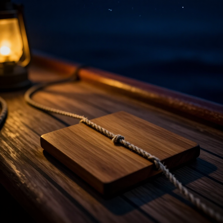
Thread and secure the cord

Thread a length of thin, strong cord approximately 50-60 cm long through the centre hole. Tie a knot on the front face of the board (the side facing away from the observer) large enough to prevent the cord from pulling through. The cord should be smooth, non-stretchy, and thin — cotton string or waxed linen thread works well. The cord must not stretch under tension, as any stretch changes the distance and therefore the measured angle.

Materials for this step:

Cotton Kitchen StringCotton Kitchen String1 meter
5

Calibrate the first knot for your home latitude

On a clear night, face north and locate Polaris. Hold the kamal board at arm's length with the cord in your teeth, the lower edge aligned with the horizon, and adjust the cord length until the upper edge just touches Polaris. When the board exactly frames the angle between horizon and Polaris, pinch the cord where it meets your lips and tie a knot at that point. This knot now represents your home latitude. Any time you hold the board with this knot between your teeth and the board exactly frames horizon to Polaris, you are at the same latitude.
6

Add knots for other latitudes

To calibrate the kamal for other latitudes, travel to a different location (or calculate the cord length mathematically). Each degree of latitude changes the altitude of Polaris by one degree. The relationship between knot spacing and latitude is not linear because of the tangent function — knots for higher latitudes (shorter cord) are spaced closer together than knots for lower latitudes. Arab navigators typically tied knots for each port they regularly visited, often labelling them with small beads or marks.
7

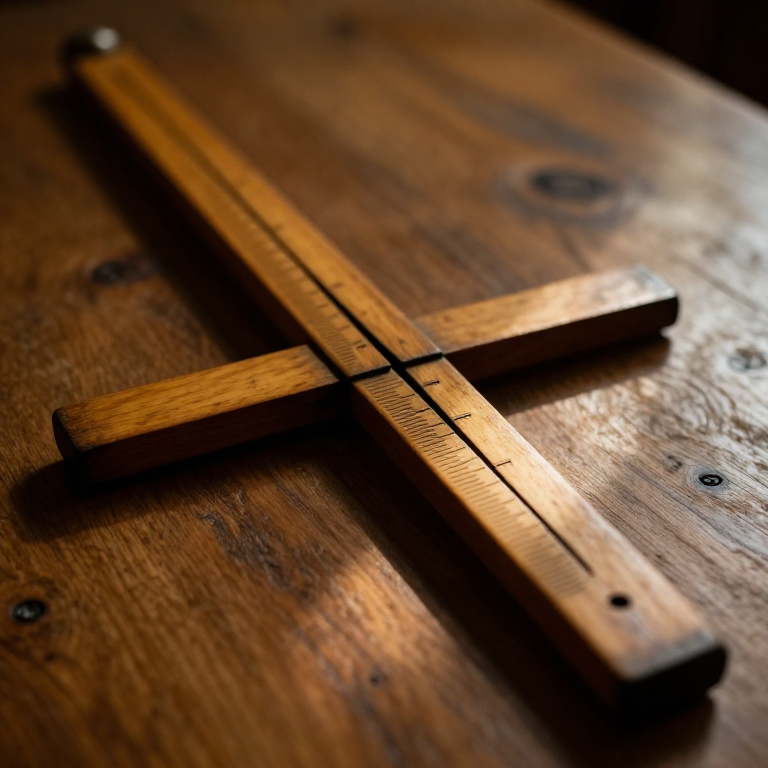
Calculate knot positions mathematically

If you cannot travel, calculate the cord length for any latitude using trigonometry. The cord length L for a given altitude angle A and board half-height H is: L = H / tan(A). For a board 5 cm tall (H = 2.5 cm), latitude 30° needs L = 2.5 / tan(30°) = 4.33 cm, and latitude 50° needs L = 2.5 / tan(50°) = 2.10 cm. Measure from the board face and tie knots at each calculated distance. This gives a complete set of latitude knots without leaving home.

Tools needed:

Measuring RulerMeasuring Ruler
8

Practise the observation technique

Hold the kamal board between thumb and forefinger of one hand with the cord running to your mouth. Bite the appropriate knot between your front teeth and pull the board away until the cord is taut. Close one eye and align the lower edge of the board with the sea horizon (or a level horizon). The upper edge should just touch Polaris. If Polaris sits above the board, you are south of the knot's latitude — sail north. If Polaris is below the upper edge, you are north of it — sail south. With practice, the kamal can measure latitude to within about one degree.
9

Navigate by latitude sailing

The kamal enables latitude sailing — the primary open-ocean navigation technique of the medieval Indian Ocean. To reach a destination, first sail north or south until your kamal shows the destination's latitude (the correct knot produces a perfect horizon-to-Polaris frame). Then turn east or west and maintain that latitude by checking the kamal nightly. If Polaris rises above the board, you have drifted north — correct southward. If it drops below, correct northward. Ahmad ibn Mājid navigated the monsoon routes from East Africa to India using this method.
10

Extend the kamal for daytime use

The kamal can also measure the altitude of the Sun at noon (when it crosses the meridian) to find latitude during the day. Hold the board with its lower edge on the horizon and its upper edge at the Sun's lower limb — never look directly at the Sun; instead, observe the shadow cast by the upper edge onto your hand below. The noon Sun altitude combined with the Sun's declination for the date (found in almanac tables) gives your latitude. Arab navigators combined kamal observations of Polaris at night and the noon Sun by day to fix their position with remarkable accuracy.

សម្ភារៈ

2

ឧបករណ៍ចាំបាច់

3

Connected Blueprint Materials

ប្លង់ពាក់ព័ន្ធ

ប្លង់ទាំងនេះចែករំលែកចំណេះដឹង — បច្ចេកទេស សម្ភារៈ ឬគោលការណ៍

CC0 សាធារណៈ

ប្លង់នេះត្រូវបានចេញផ្សាយក្រោម CC0។ អ្នកមានសិទ្ធិចម្លង កែប្រែ ចែកចាយ និងប្រើប្រាស់ដោយមិនចាំបាច់សុំអនុញ្ញាត។

គាំទ្រអ្នកបង្កើតដោយទិញផលិតផលតាមរយៈប្លង់របស់ពួកគេ ដែលពួកគេទទួលបាន កម្រៃជើងសារអ្នកបង្កើត កំណត់ដោយអ្នកលក់ ឬបង្កើតកំណែថ្មីនៃប្លង់នេះ ហើយបញ្ចូលជាការតភ្ជាប់ក្នុងប្លង់របស់អ្នកដើម្បីចែករំលែកចំណូល។

ការពិភាក្សា

(0)

ចូល ដើម្បីចូលរួមពិភាក្សា

កំពុងផ្ទុកមតិ...